Follow petcha on Twitter
Search
Journals
Amazon Associate

If you see books or music or tools on this site that you would like to buy through Amazon, click here and thus i have seen will get a small percentage of the purchase price of the item. Thank you. 

The Elements of Typographic Style

Patagonia Synchilla Snap-T Pullover

Minding the Earth, Mending the Word: Zen and the Art of Planetary Crisis

North Face Base Camp Duffel (Medium)


Entries in Tikon (12)

Thursday
Oct312013

Faces of Tikon


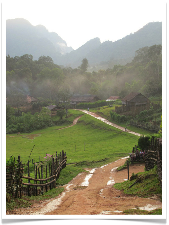
This is what the village of Tikon looks like the first time you arrive and the rain has just stopped and the sun comes out and you are very happy to have finally made it. You are up at over 4000 feet and things have started to get a little chilly.
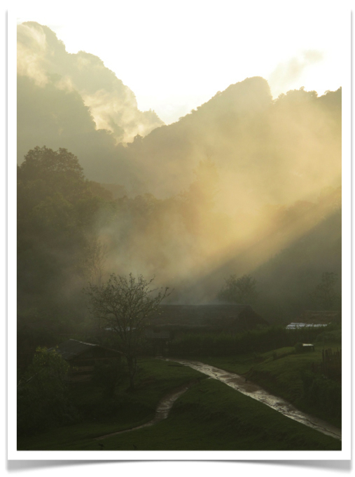
And this is what the village looks like in the late afternoon when you've walked out to find the path to tomorrow's transect and you turn back to check out the landscape. Magical. [NOTE: It was clear and sunny every day that we worked in the field and only started raining the last day when we walked out to Mile 25 camp. Magical].

Wednesday
Oct302013

Tikon


N 25.50226°
E 95.02700° 

Back in Yangon with internet. Image above shows the start of Transect 1 (note red transect rope) in the forest outside of Tikon in the Naga Hills Autonomous Region of Sagaing Division. Some of the most beautiful tropical montane forest I've ever seen. Tikon is a lovely Chin/Naga village of 13 households that has been in the same place for 96 years. You walk for ten miles to get there. More on this incredible place later.

Page 1 2